


Integrated Geodetic Spatial Reference
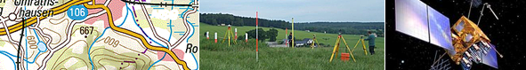
Professional understanding of official geodetic spatial reference in Germany has evolved consistently over past decades. Today Germany has established the integrated geodetic spatial reference as a holistic approach to the geometrically and physically defined components. AdV has placed this at the centre of its product view and definition for geodetic spatial reference. They have also given special attention to the quality assurance of the reference framework, which is realised by the unified field of geodetic control points.
The improvement in accuracy in the integrated geodetic spatial reference is an important step in the application of GNSS technology provided by the German satellite positioning service, SAPOS®. Today SAPOS®, which integrates ‘cm geoid GCG2016’, can be also used to determine normal height. The integrated geodetic spatial reference is considered a basic infrastructure and part of AdV’s legal remit.
PDF presentation on the "integrated geodetic spatial reference" for download
Further reading (in German), free of charge PDF download:
Documentation of the measurements and the establishment of the integrated geodetic spatial reference (in German) for download
Feldmann-Westendorff, U., Liebsch, G., Sacher, M., Müller, J., Jahn, C.-H., Klein, W., Liebig, A., Westphal, K.: Das Projekt zur Erneuerung des DHHN: Ein Meilenstein zur Realisierung des integrierten Raumbezugs in Deutschland, zfv 5/2016
Link: http://geodaesie.info/zfv/heftbeitrag/5844
Heckmann, B., Berg, G., Heitmann, S., Jahn, C.-H., Klauser, B., Liebsch, G., Liebscher, R.: Der bundeseinheitliche geodätische Raumbezug – integriert und qualitätsgesichert, S. 180-184, zfv 3/2015
Link: http://geodaesie.info/zfv/heftbeitrag/4648
Pruduct Standards (in German):