


Digital Basic-Landscape model (Basis-DLM)
Digital Basic-Landscape model (Basic-DLM)
The Basis-DLM describes the topographic objects of the landscape and the relief of the Earth’s surface in vector format. The objects are defined according to their spatial position, geometric type, descriptive attributes and relations to other objects. Every object has a unique identification number (identifier) throughout Germany. The spatial position for the Basis-DLM is stated independent of scale and mapping in the State survey coordinates system. The ATKIS® Feature Type Catalogue (ATKIS®-OK Basis-DLM) specifies which feature types the DLM contains and how the objects must be formed.
The ATKIS®-OK Basis-DLM including explanations and modelling examples is provided as a no-charge download. The OK is available only in german (GeoInfoDok).
You can find further meta information in the Geoportal.de.
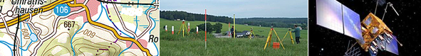
Presentation graphic
Automatic presentation of the Basis-DLM data
Gnoien, Mecklenburg-Vorpommern