


A warm welcome to the AdV
The Working Committee of the Surveying Authorities of the Laender of the Federal Republic of Germany (AdV) is the German umbrella organisation of the authorities of the 16 Laender of the Federal Republic of Germany competent for land surveying and cadaster and of three federal authorities. For more information please use the menue.
National Report of AdV 2022/2023
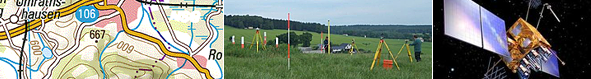
Smart Mapping: The new vector map is online
At the same time, the new shading service was activated. With basemap.de Web Raster Shading, a Germany-wide shading service for subsequent use in any technical and thematic maps is provided. The service contains oblique shading, a combined shading of oblique and embankment shading as well as a height layer display based on the ATKIS-DGM5 of the surveying authorities of the federal states.
All details about the services can be found on the product web page.
You can use the basemap.de viewer to view the maps, but you can also use them on the go via smart phone, print them out, adapt them and release them for specific sections.
National Reports 2020/2021
15th November 2021 Recently, AdV published its National Report 2020/2021, describing latest achievements in the world of geospatial information and surveying as well as future-oriented projects to ensure that authoritative geospatial data will address future generations' needs. One flagship project is Smart Mapping that revolutionizes the processes to elaborate authoritative maps. For more information, find the report here. https://www.adv-online.de/Publications/AdV-National-Reports/
Main document of the GeoInfoDoc - Version 7.0.2
13th May 2017 In the AAA® project, AdV conceived an integrated and coordinated modelling of all geospatial data from the Surveying, Mapping and Cadastre Authorities of Germany and implemented it through its member administrations. The procedure is described in detail in the main document of the "Documentation on the modelling of the geoinformation of the official surveying system (GeoInfoDok)". In addition to the current version 6.0.1 of the main document, version 7.0.2 is also available in English.
Guidelines for the nationwide uniform archiving of geographic reference data
1st January 2017 For many years surveying and mapping authorities and the archive authorities of the Laender of Germany are working together with regard to the delivery of analogue products, particularly maps. More and more the surveying and mapping authorities produce digital data, and new ways have to be set up for basic uniform regulations for the process of archiving digital geographic reference data.
For this reason, AdV and the Conference of Directors of the Archive Authorities of the Federal Government and the Laender (KLA) appointed a joint working group to develop a document on a harmonised approach to this challenge. Both AdV and KLA adopted the resulting guidelines at the end of 2015. The complete document has now been translated into English