

Digital Topographic Map 1:25 000 (DTK25)
The Digital Topographic Map 1:25 000 is
-
the DTK25 derived from the Basis-DLM and a corresponding DTK computer supported in the ATKIS® map graphics and produced in raster format or
-
the raster data set created from the conventional 1:25 000 topographic map by scanning. This is managed as the “Provisional Edition” DTK25-V.
With increasing provision of the DTK25, this will displace the DTK25-V and completely replace it in the future.
Rules, according to which the individual Basis-DLM object types and/or the combination of several Basis-DLM object types (e.g. complex objects) and DTK contents are portrayed, derivation rules for forming presentation objects and a description of all occurring map portrayals are specified in the portrayals catalogue for the DTK25 (ATKIS®-SK25).
The ATKIS®-SK25 is an integral part of the ATKIS®-documentation and is provided as a no-charge download in the Documentation for the Modelling Geoinformation of Official Surveying and Mapping (GeoInfoDok). Except the main document, this documentation is not available in english.
You can find further meta information in the Geoportal.de.
map section
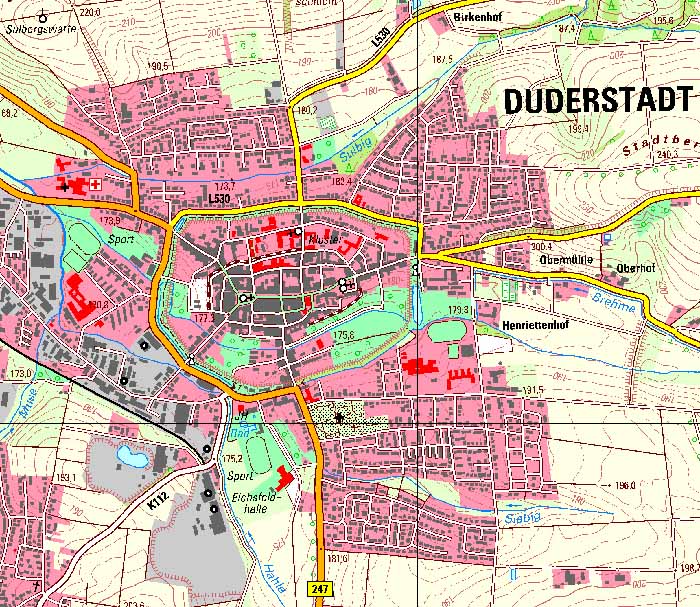
section of the sample map sheet 4427 Duderstadt